|
|
When the location data
is expressed in geographic coordinates, the add-in has an interface
to Google
Earth. The figure below shows the buttons on the Results worksheet.
The Google Earth button appears at
the lower right. A similar button appears on the Model worksheet. |
| |
|
| |
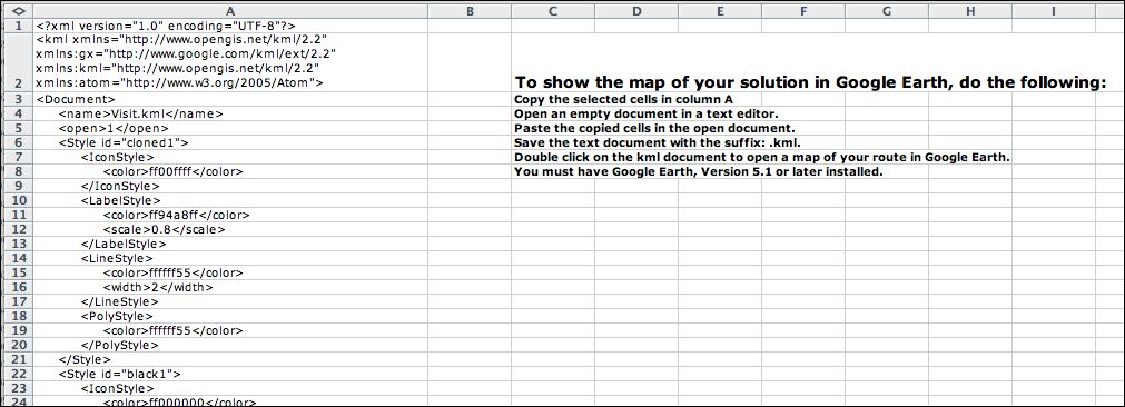
Clicking the button initiates
a subroutine that creates a program
that plots the current solution on a visual replica or the
earth provided by the Google Earth application. The picture
below shows the first few lines of the program. The program
is entirely in column A of the Google worksheet. For the example
on this page
649 rows are required for the program. Select the program lines
in column A and copy the contents. The proper rows are already
selected when the program is displayed. Open a text
editor and paste the clip bound to an empty document. Save
the document with a name reflecting the model with the suffix
.kml. Then double click on the document icon.
The Google Earth application
automatically runs and displays the current routing solution.
Of course the Google Earth application must be installed on
your computer. I use version 5.5. |
|
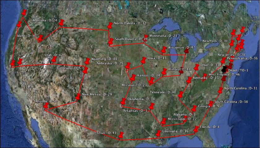
Google Earth |
| |
The example illustrates a route
through the state capitals in the continental United States
(with Washington DC added). The depot for the single
vehicle is Washington DC, indicated by a black pushpin. The
red pushpins indicate the capital cities. |
|
| |
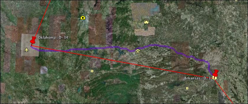
We ask Google Earth for a route from
Little Rock, Arkansas to Oklahoma City, Oklahoma, and the route
shown in purple below is traced. This route compares with the
straight line of our Excel generated route because it follows
real roads
rather than the Great Circle route. Google Earth reports a distance
of 336 miles rather than the 297 miles computed by the Great
Circle function. Of course the straight line route is shorter
than the driving distance along real roads |
|
| |
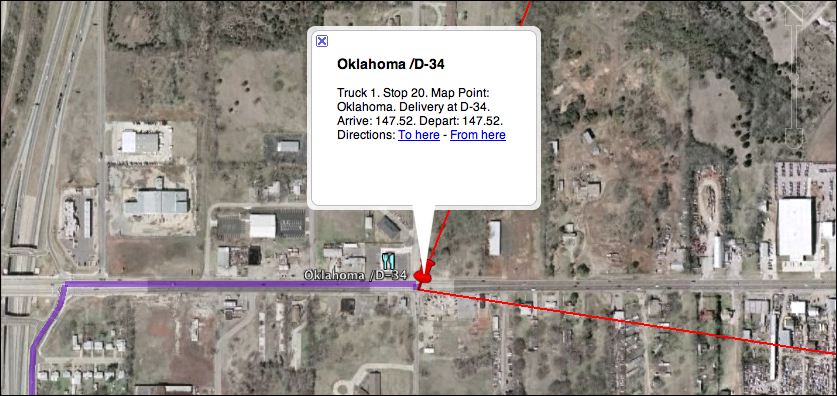
Zooming into the Oklahoma City map
we see the actual point for the coordinates specified
by our data. Apparently the point does not represent the capital
building. The balloon shows details of the visit reported by
the Excel solution. |
 Ç |
| |
The interface with Google Earth is
an important extension of the Routing add-in. The add-in
uses approximate
distances to find the optimum sequence of visits. Google Earth
displays the routes and uses real time data to find specific
routes between pairs of locations. |
| |
|